The most efficient and versatile LiDAR and digital photogrammetry services, no matter the environment.
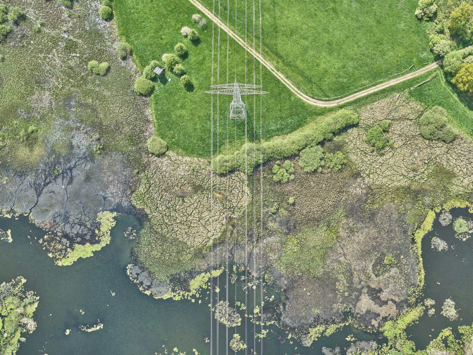
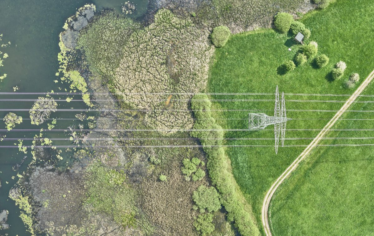
A unique combination of laser scanners, high-resolution digital cameras, and advanced navigation systems (GNSS-IMU) for corridor mapping and more.
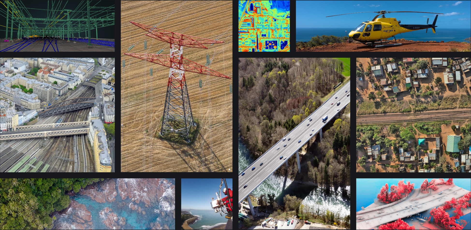
Worldwide LiDAR mapping & imagery services
We transform the most accurate data into tailored geospatial solutions to meet your needs no matter the industy or its application
LiDAR
Up to 800 points per sq Km, 2-5 cm absolute precision, and 200 km/day anywhere!
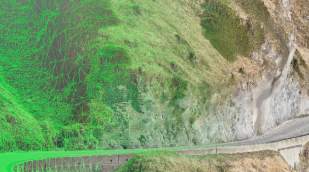
Ultra dense Point clouds
State-of-the-art technology, designed for specific applications and high performance.
Photogrammetry
6 simultaneous cameras for photo-realistic 3D models and reality mapping
High resolution Orthoimages
High resolution orthophotos and 2D/3D high detail drawings and mapping services
Asset Inspection
Custom Nadir and oblique surveys for visual inspection and reports
HD Oblique imagery
Exclusive Mapping technique for Complex and inaccessible areas survey
NIR, Thermal,360
Specific and research applications using thermal and other technologies
Research & development
Scalable data processing for Engineering, BIM, risk assessment or utilities among others.
Best technical approach for each project
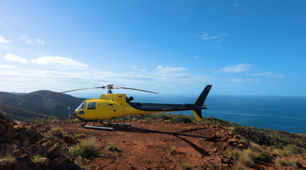
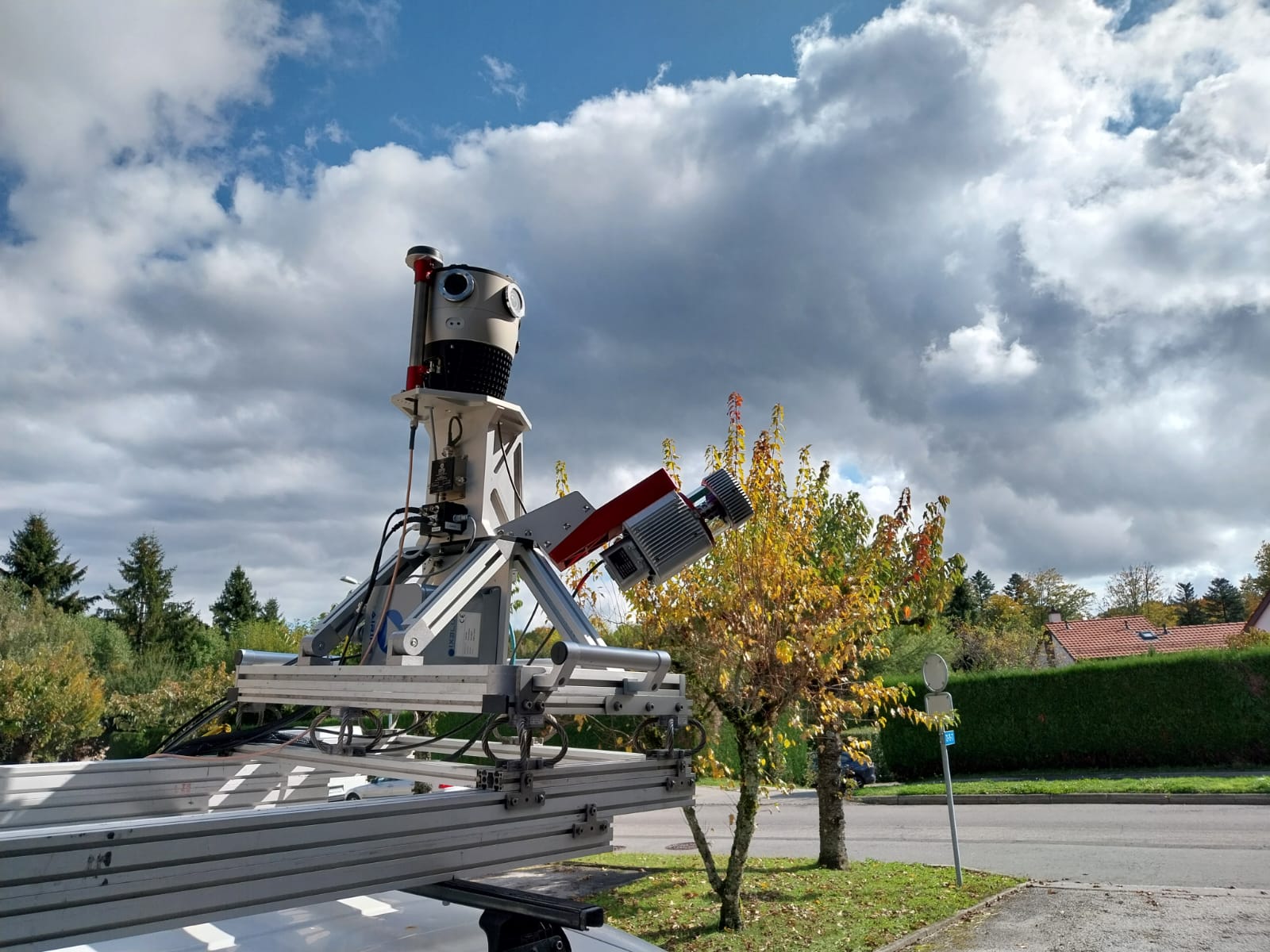
Customizable Helimap Systems® for optimal data quality and performance.
The right combination of cutting-edge technology, knowledge, experience & proficient skills as guarantee of reliable and cost-effective surveys. Because good sensors ONLY do not make good and accurate data, Sixense Helimap has different approaches depending on your project needs:
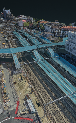
CORRIDOR MAPPING
Optimal corridor mapping services for planning, maintenance, Digital Twins or BIM of infrastructures.
Performance beyond 200 km/day
Up to 1000m coverage in a single pass
Multi-Survey: LiDAR, imagery, inspection and NIR or thermal in the same flight
Up to 5mm resolution and 800 pts/sqm LiDAR density
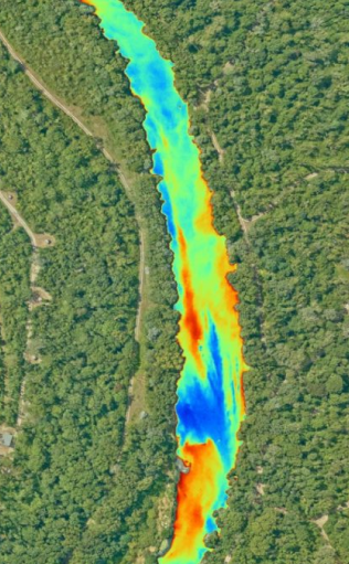
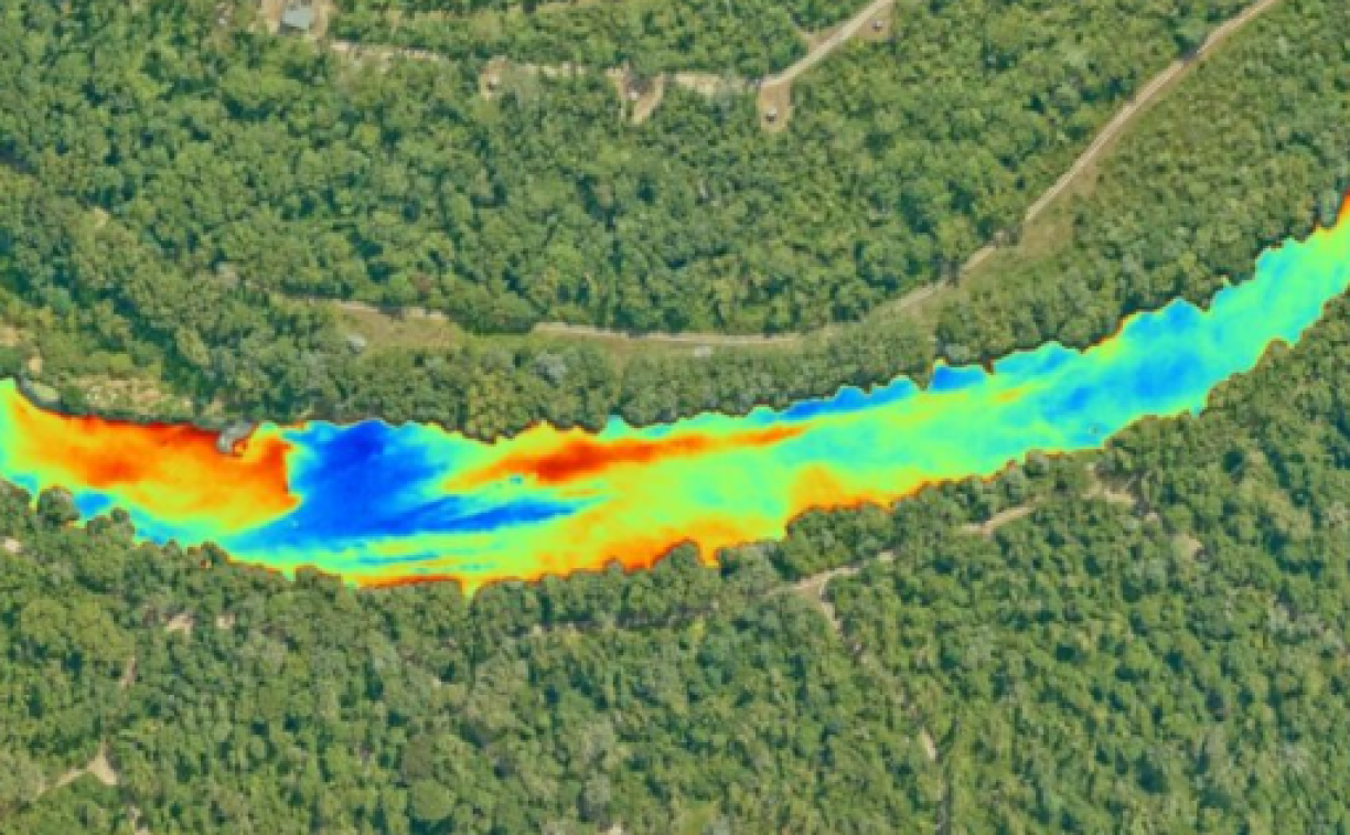
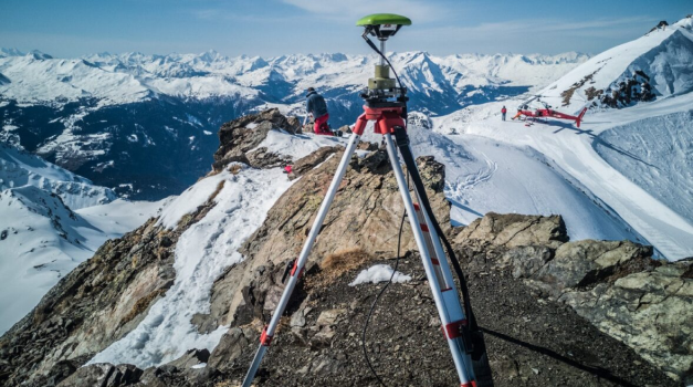
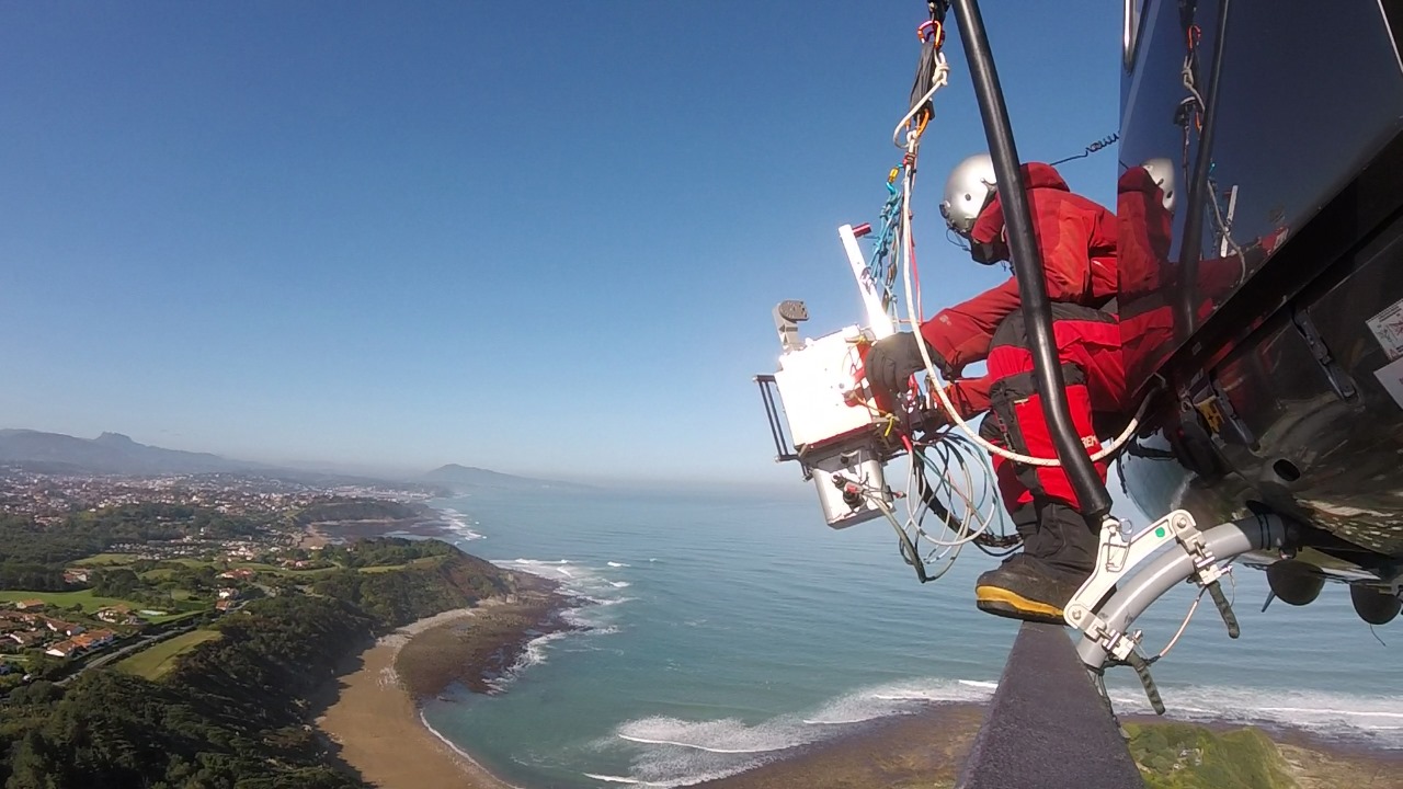
COMPLEX TERRAIN SURVEYS
Efficient and reliable surveys in complex environments and remote areas
Unique Oblique survey approach on Helicopters to avoid terrain distorsion and shadows
More than 15 years of experience surveying mountains, narrow valleys and glaciers.
Multiple sensors and cameras combination
Specific system configuration for mountain areas
RAPID MAPPING /
DISASTER MANAGEMENT
Experts in rapid mapping, we respond very quickly to disasters and hazards (landslides, floods, avalanches, etc.)
Capacity to mobilize under short period notice
Experience in monitoring and surveying sensible areas
Monitoring risk areas for optimal decision making and planning
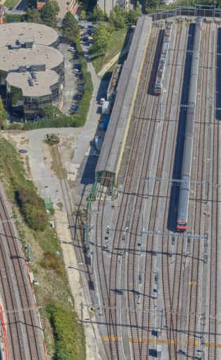
KINEMATIC LIDAR FOR TUNNELS, UNDERPASSES AND TERRESTRIAL SURVEYS
High-density mobile mapping surveys, carried out by car or train
Able to perform at night
The best complement for aerial surveys (tunnels, bridges, etc.)
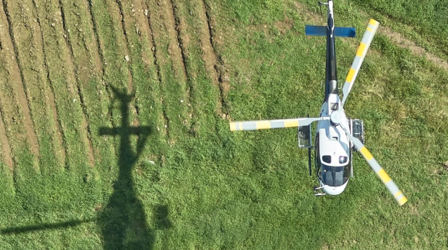
Multi-platfom adaptability
Oblique
acquisition
Vertical
acquisition
Mobile Mapping
Key benefits
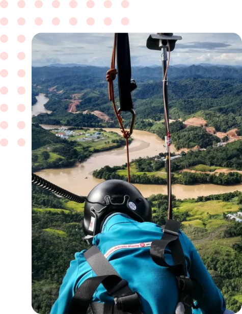
Since 2005 Sixense Helimap combines cutting-edge technology, Knowledge, Experience & Proficient Skills to perform the most accurate LiDAR @ Photogrammetry services in the 5 continents
INTERNATIONAL EXPERIENCE & MARKET KNOWLEDGE
15 years of experience and thousands of Km processed every year for engineering, infrastructure management, risk assessment and more.
CUTTING EDGE TECHNOLOGY FOR ANY ENVIRONMENT
8 fully configurable systems to guarantee the flexibility that your project demands… anytime, anywhere.
HIGH PRECISION & ACCURACY
Our state-of-the-art technology, including high definition scanners and cameras, is backed by a specialized staff providing personalized services, all driven by our unwavering commitment to quality.
FLEXIBILITY
Our modular acquisition system allows for vertical or oblique acquisition, with flexible installation on various aerial and terrestrial platforms, no matter the country
REACTIVITY
With rapid mobilization taking just a few hours in Switzerland, Germany or France, our quick installation process ensures being operational under very short notice.
INNOVATION
8 sensors. Short period notice mobilisation and optimal risk management.
Industries & applications
The combination of our experience, a unique technology and our team of project managers allow us to take care of any project from early stages of planning to Digital Twin or BIM models design among others